What is Mapping Nature?
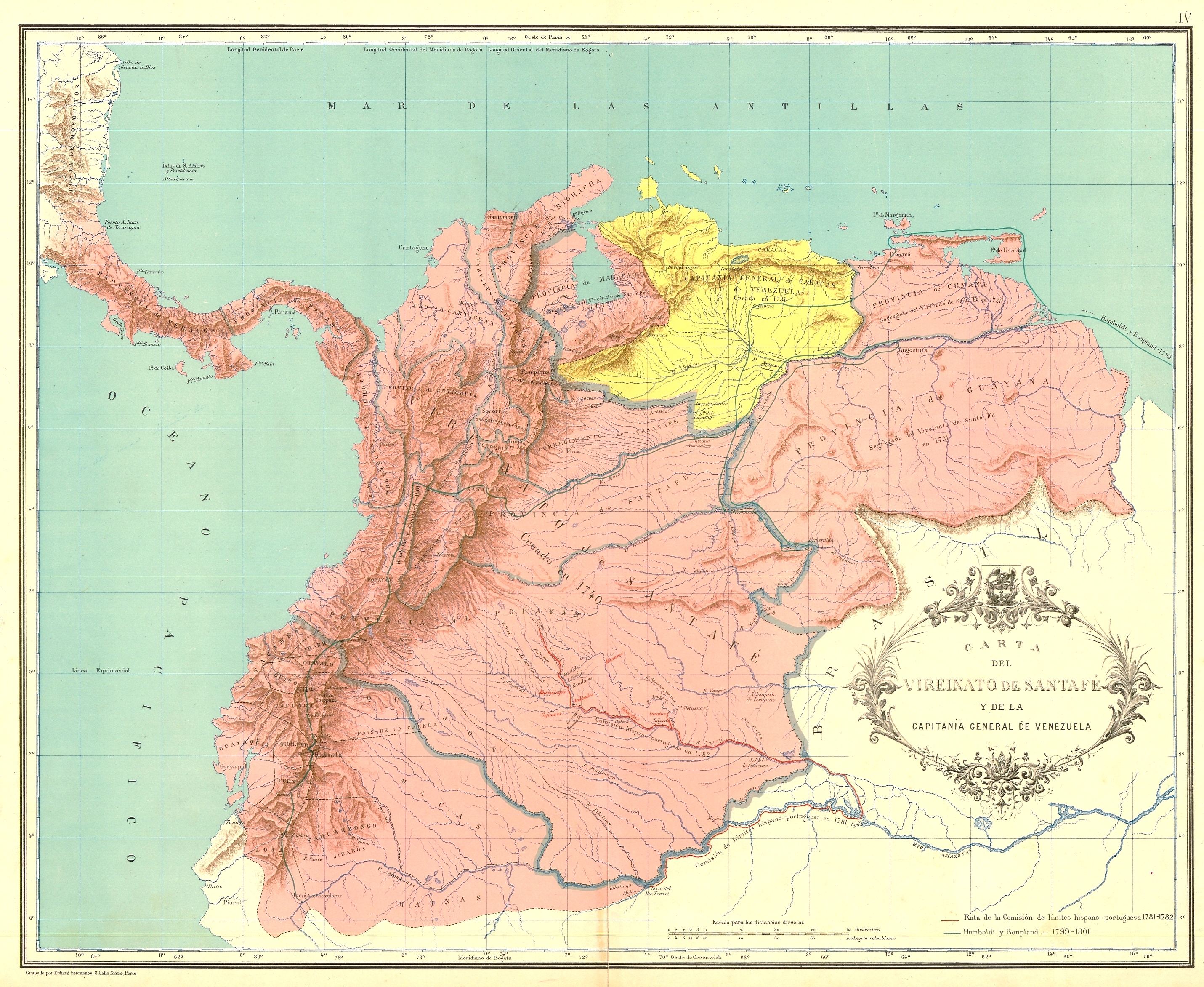
Mapping Nature in New Granada is a project of digital humanities that seeks to develop an interactive visualization tool to navigate and analyze boundary changes, and the changing landscape of agriculture, mining, manufacture economies, and commercial communication networks between 1739 and 1830 in northern South America. The territories that formed the viceroyalty of New Granada are contemporary Colombia, Venezuela, Panamá and Ecuador.
Expected ResultsAn interactive map with mines, landmarks, plantations, ports, roads, and rivers, indexing digitized documents including economic writings, natural histories, territorial surveys, geographic descriptions, and cartographic materials. A dynamic timeline featuring information about key geopolitical events of the time will allow the user to draw comparisons and relationships between the geopolitical realignment of the period and transformations in the political economy.
Why?Mapping Nature in New Granada builds on my own dissertation research that explores the connections between political economy, discourses about nature, and the international and provincial geopolitics during the crisis and dissolution of the Spanish empire.
This page uses Ground Floor to style the page, click here to see some code examples. You can opt-out of this style and make your own design by removing the "default.css" link in the HTML.